Erstellen von Grundriss-Plänen mithilfe der HoloLens 2
2 Anwendungen, mit denen von einer HoloLens 2 gesammelte Umgebungsdaten ausgewertet und in Grundrisspläne der jeweils erfassten Räume umgewandelt werden können.
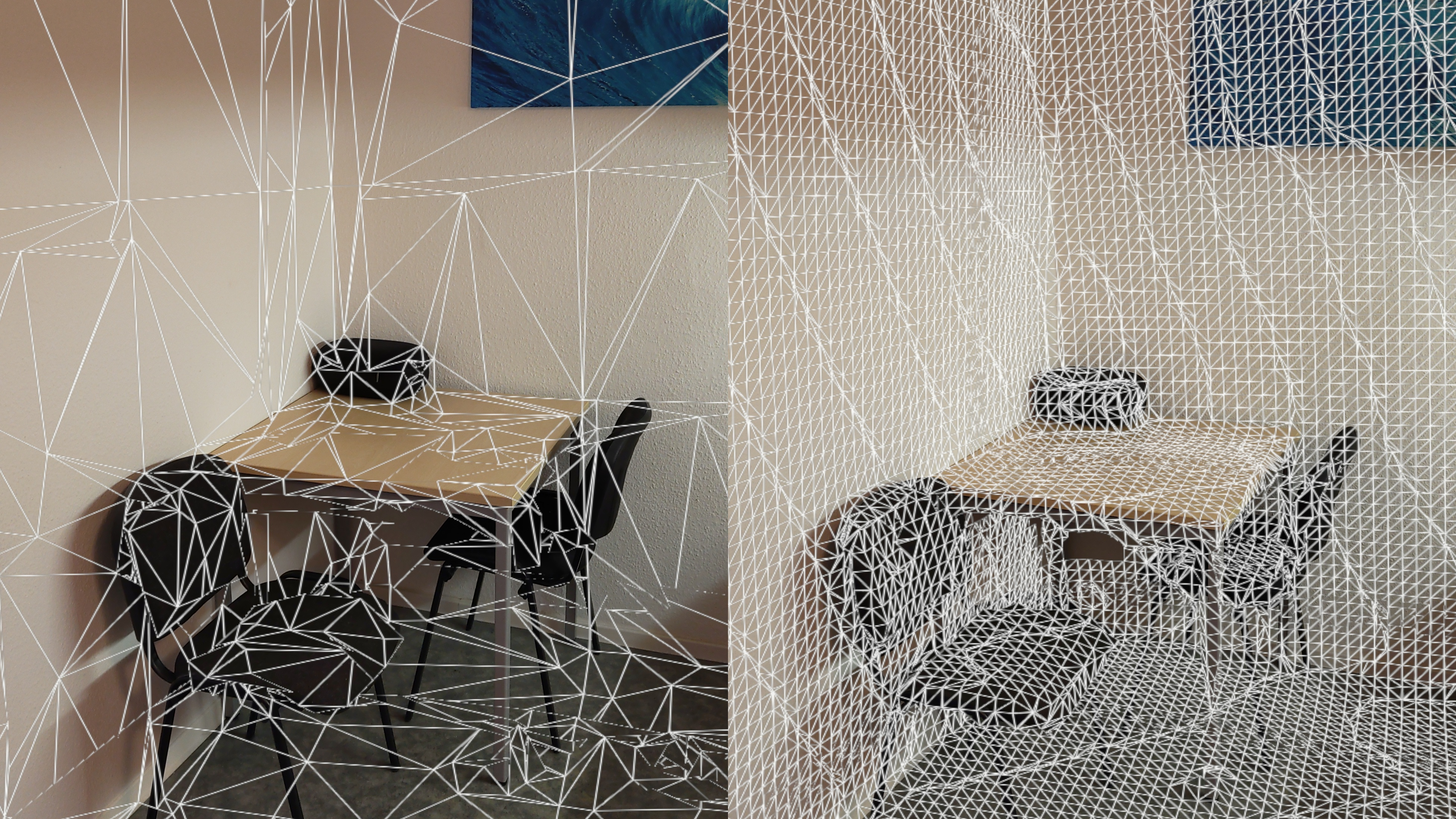
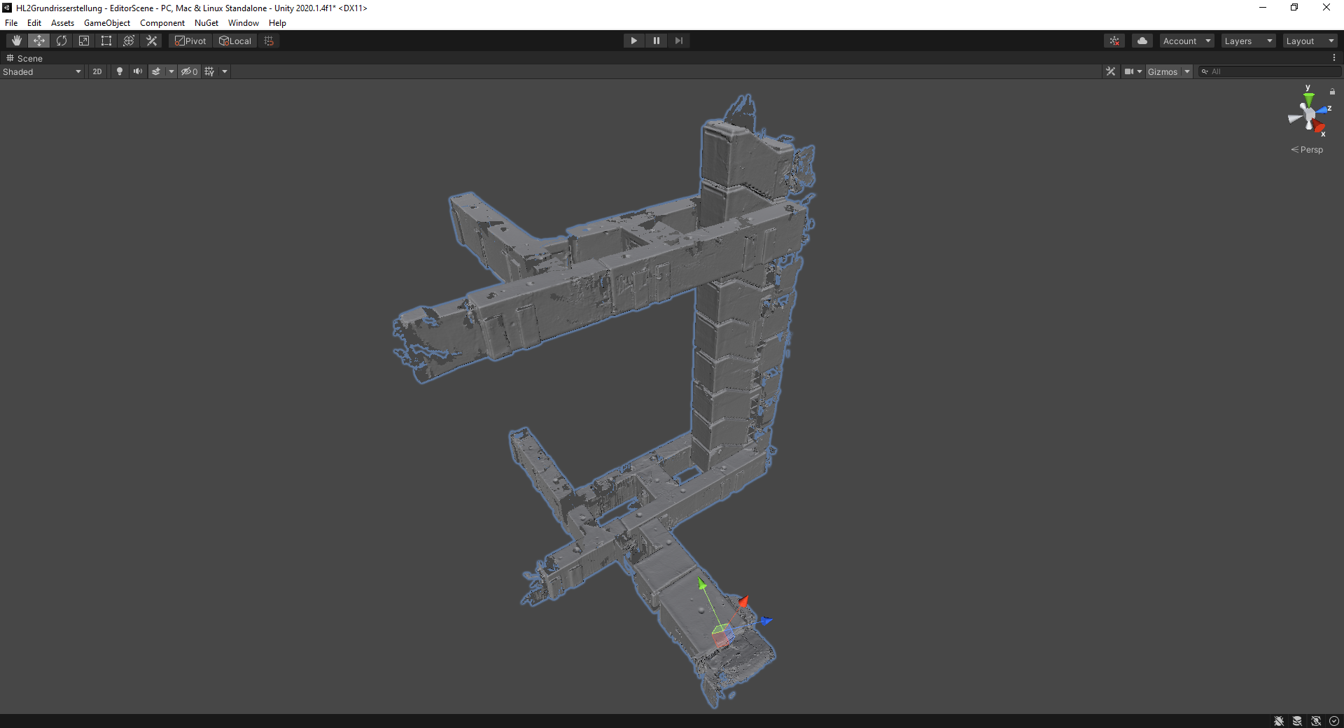
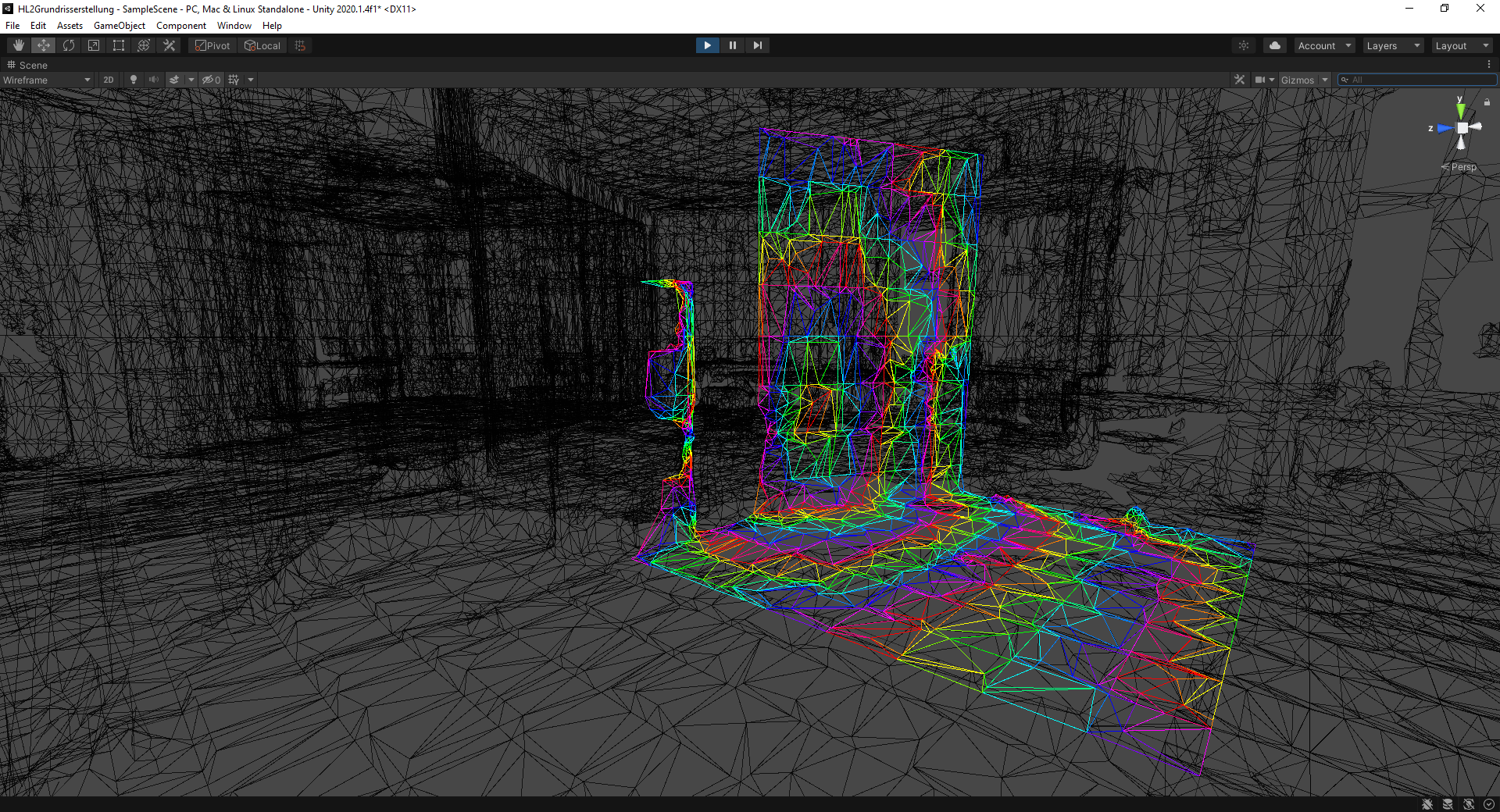
Die HoloLens 2 erstellt kontinuierlich eine Mesh-Repräsentation der sie umgebenden Geometrie, um beispielsweise das korrekte Platzieren von Objekten in ihrem Umfeld zu ermöglichen. Die erste Anwendung, welche auf dem Gerät läuft, stellt das so generierte Mesh über der Umgebung dar und kann es in den Gerätespeicher exportieren.
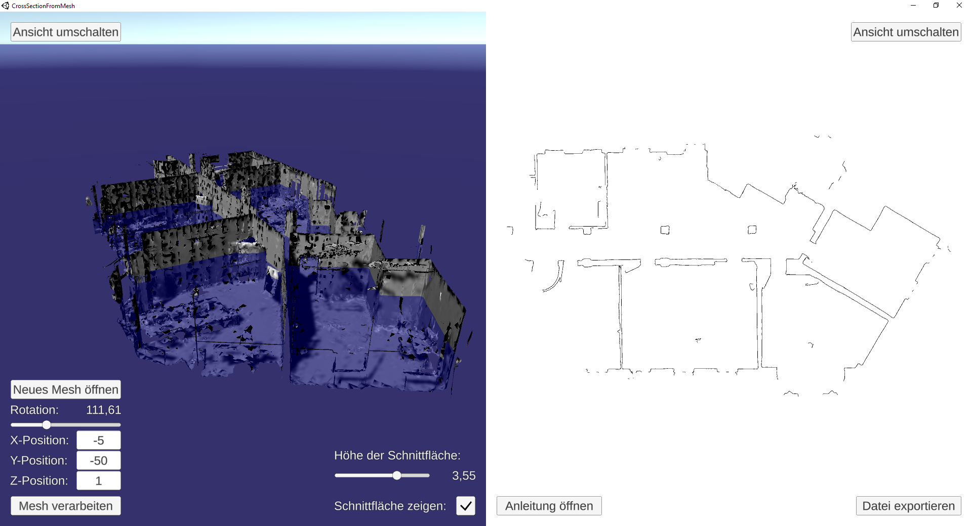
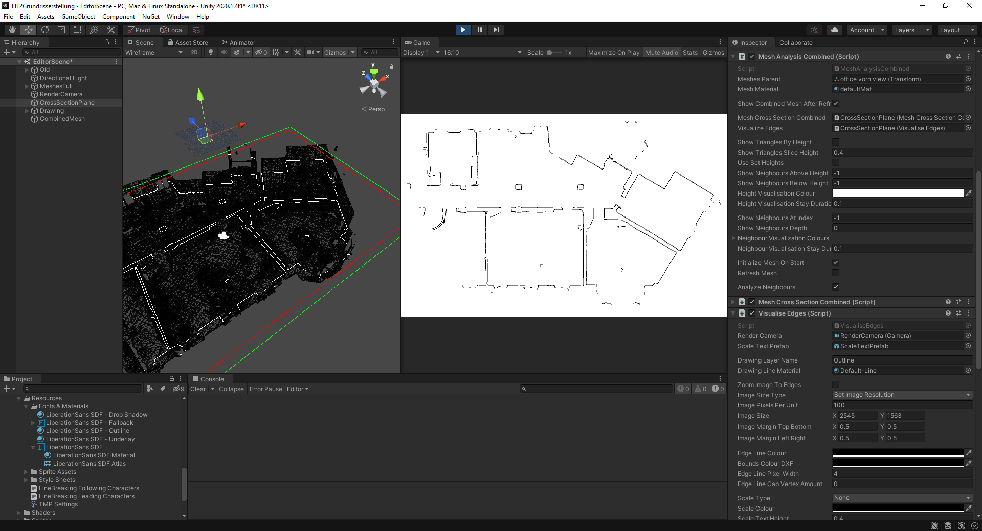
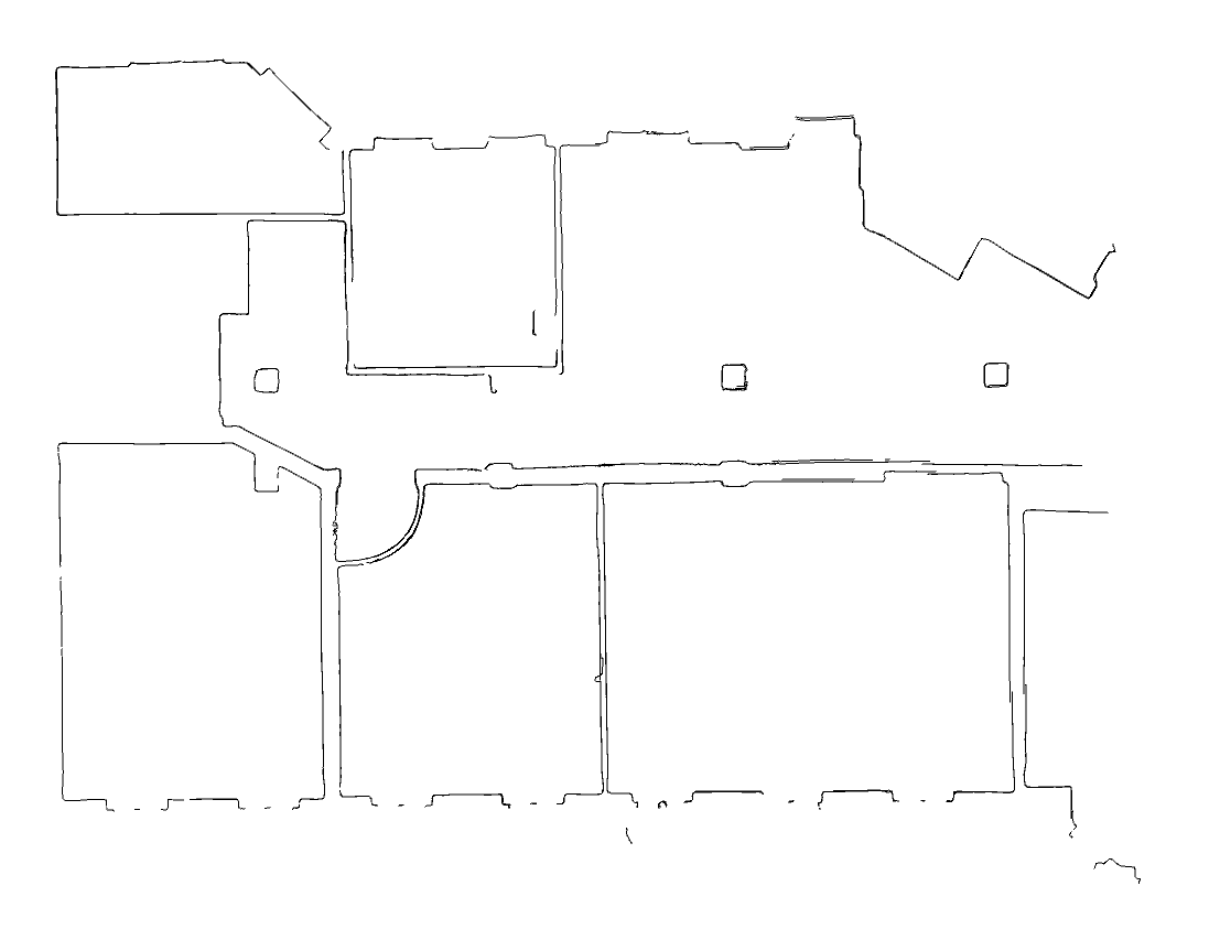
Die zweite Anwendung, welche auf einem externen PC läuft, kann entweder als vollwertige In-Editor-Version oder als eigenständiges Programm mit nur grundlegenden Funktionen genutzt werden. Sie analysiert das zuvor erstellte Mesh, woraufhin ein schlichter Grundrissplan erzeugt und als Raster- oder Vektorgrafik exportiert werden kann.
Zur Umsetzung diente mir Unity sowie Microsofts Mixed Reality Toolkit. Die Anwendungen sowie den beschriebenen Prozess entwickelte ich im Rahmen meiner Bachelorarbeit ("Innenraumausmessung und automatisierte Grundrisserstellung mithilfe der Microsoft HoloLens 2").
Build-Download der Anwendung zur Planerstellung [Windows] [Deutsch]
Download für einen Beispielplan im PNG-Format
Download für einen Beispielplan im DXF-Format
Download des Exposés meiner zugehörigen Bachelorarbeit im PDF-Format [Deutsch]
Download meiner zugehörigen Bachelorarbeit im PDF-Format [Deutsch]
2021-02-24
Creating ground plans with the HoloLens 2
2 applications that allow environmental data collected by a HoloLens 2 to be analysed and converted into floor plans of the captured spaces.
The HoloLens 2 continuously creates a mesh representation of the geometry surrounding it, to enable, for example, proper placement of objects in its surrounding. The first application, which runs on the device, overlays the generated mesh onto the environment and can export it to local storage.
The second application, running on an external PC, can either be used fully featured in-editor or as a basic standalone version. It's used to analyse the mesh created previously, after which a basic floor plan can be created and exported as a raster or vector image.
Unity and Microsoft's Mixed Reality Toolkit were used for the implementation. I developed both applications and the described process as part of my bachelor thesis ("Interior measurement and automated floor plan generation using the Microsoft HoloLens 2").
Build download for the floor plan creation application [Windows] [German]
Download for an example plan in PNG format
Download for an example plan in DXF format
Download for the synopsis of my associated bachelor thesis in PDF format [German]
Download for my associated bachelor thesis in PDF format [German]
2021-02-24
